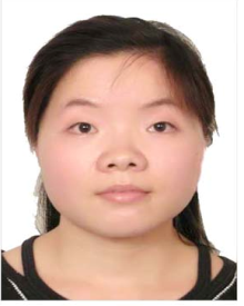
李昭

李昭,女,湖北荆州人,1983年2月生。工学博士,教授,博士研究生导师。入选2021年国家海外引进高层次人才计划青年项目及湖北省第十一批“百人计划”(创新人才项目)。
主要从事高精度卫星定位理论方法研究,在GNSS基准站坐标时间序列分析方面取得了突出创新成果,引领卫星导航定位时间序列中环境负载模型研究。在《Journal of Geodesy》等本领域权威期刊/会议发表高水平论文38篇(第一/通讯16篇),发明专利授权4项,软件著作权1项;主持国家自然科学基金、卢森堡国家研究基金等国家级科研项目3项。获省部级科技进步特等奖1项,一等奖2项。
E-mail: zhao.li@whu.edu.cn
办公电话:027-68778985
办公地点:武汉大学信息学部星湖实验大楼1622
·主要研究方向:卫星大地测量学
1. GNSS精密数据处理及时间序列分析
2. 环境负载建模方法及应用
3. 地球参考框架建立与维持
4. GRACE/GRACE-FO反演地球重力场
1. GNSS精密数据处理及时间序列分析
2. 环境负载建模方法及应用
3. 地球参考框架建立与维持
4. GRACE/GRACE-FO反演地球重力场
·教育经历
2002/09–2006/06 武汉大学测绘学院,测绘工程,学士
2003/01-2006/06 华中科技大学外国语学院,英语,学士
2006/09–2008/06 武汉大学测绘学院,大地测量学与测量工程,硕士
2008/09–2012/06 武汉大学测绘学院,大地测量学与测量工程,博士
·工作经历
2022/01-至今 武汉大学卫星导航定位技术研究中心,教授
2020/09 -2021/12 武汉大学卫星导航定位技术研究中心,特聘研究员
2020/07 -2020/08 香港理工大学土地测量与地理资讯学系,Research Assistant
2020/04 -2020/06 香港理工大学建筑及房地产学系,Research Assistant
2018/03 -2020/03 香港理工大学土地测量与地理资讯学系,Research Fellow
2015/01-2017/12 卢森堡大学地球物理实验室,Senior Researcher
2013/01-2014/12 卢森堡大学地球物理实验室,Researcher
·学术兼职
2020/06-至今 《Engineering》青年专家编委
2020/02-至今 《GPS Solutions》、《Earth,Planets and Space》、《Advances in Space Research》等十余种国际期刊审稿人
2020/09-至今 《武汉大学学报(信息科学版)》,《地球物理学报》等国内期刊审稿人;
·主持项目
国家自然科学基金优秀青年科学基金项目(海外). 全球导航卫星系统基准站坐标时间序列分析. 主持
国家自然科学基金面上项目. 基于地球物理效应的毫米级GNSS基准站非线性运动建模方法研究. 42174030. 2022/01-2025/12. 主持
湖北珞珈实验室专项基金. 顾及非线性变化的毫米级GNSS地球参考框架建立方法研究. 220100020. 2022/04-2025/03. 主持
卢森堡国家研究基金博士后资助项目. Quality Evaluation of Environmental loading models and Thermal Expansion Effects of GNSS Monumentation and Bedrock. 2013/01-2014/12
·期刊论文
[1] Li Zhao*, Chen Wu, van Dam Tonie, Rebischung Paul, & Altamimi Zuheir. (2020). Comparative analysis of different atmospheric surface pressure models and their impacts on daily ITRF2014 GNSS residual time series. Journal of Geodesy, 94(4), 1-20. https://doi.org/10.1007/s00190-020-01370-y.
[2] Li Zhao*, Chen Wu, Ruan Rengui, & Liu Xuexi. (2020). Evaluation of PPP-RTK based on BDS-3/BDS-2/GPS observations: a case study in Europe. GPS Solutions, 24(2), 1-12. https://doi.org/10.1007/s10291-019-0948-6.
[3] Li Zhao*, Chen Hua, & Yuan Peng. (2019). Accelerating real-time PPP ambiguity resolution by incorporating multi-GNSS observations. Advances in Space Research, 63(9), 3009-3017. https://doi.org/10.1016/j.asr.2018.05.018.
[4] Li Zhao*, Chen Wu, Jiang Weiping, Deng Liansheng, & Yang Ronghua. (2018). The magnitude of diurnal/semidiurnal atmospheric tides (S1/S2) and their impacts on the continuous GPS coordinate time series. Remote Sensing, 10(7), 1125. https://doi.org/10.3390/rs10071125.
[5] Deng Liansheng, Jiang Weiping, Li Zhao*, Chen Hua, Wang Kaihua, & Ma Yifang. (2017). Assessment of second-and third-order ionospheric effects on regional networks: case study in China with longer CMONOC GPS coordinate time series. Journal of Geodesy, 91(2), 207-227. https://doi.org/10.1007/s00190-016-0957-y.
[6] Wu Shuguang, Li Zhao*, Li Houpu, Nie Guigen, Liu Jingnan, & He Yuefan. (2021). Application of an improved clustering approach on GPS height time series at CMONOC stations in Southwestern China. Earth, Planets and Space, 73(1), 1-15. https://doi.org/10.1186/s40623-021-01559-1.
[7] Deng Liansheng, Li Zhao*, Wei Na, Ma Yifang, & Chen Hua. (2019). GPS-derived geocenter motion from the IGS second reprocessing campaign. Earth, Planets and Space, 71(1), 1-17. https://doi.org/10.1186/s40623-019-1054-2.
[8] Ma Jun, Li Zhao*, Jiang Weiping, Cao Chengdu, Huo Liang, & Zhou Xiaohui. (2020). A new three-Dimensional noise modeling method based on singular value decomposition and its application to CMONOC GPS network. Earth and Space Science, 8, e2020EA001250. https://doi.org/10.1029/2020EA001250.
[9] Zhao Li*, & Dam Tonie van. (2015). The phase 2 north america land data assimilation system (nldas-2) products for modeling water storage displacements for plate boundary observatory gps stations. In: van Dam T. (eds) REFAG 2014. International Association of Geodesy Symposia, vol 146. Springer, Cham. https://doi.org/10.1007/1345_2015_176.
[10] Li Zhao*, van Dam Tonie, Collilieux, X., Altamimi, Z., & Nahmani, S. (2015). Quality evaluation of the weekly vertical loading effects induced from continental water storage models. Springer International Publishing. In: Rizos C., Willis P. (eds) IAG 150 Years. International Association of Geodesy Symposia, vol 143. Springer, Cham. https://doi.org/10.1007/1345_2015_174.
[11] Li Wudong, Jiang Weiping, Li Zhao*, Chen Hua, Chen Qusen, Wang Jian, Zhu Guangbin. (2020). Extracting common mode errors of regional gnss position time series in the presence of missing data by variational bayesian principal component analysis. Sensors (Basel, Switzerland), 20(8). https://doi.org/10.3390/s20082298.
[12] Fan Qian, Chen Zhenjian, Li Zhao*, Xia Zhanghua, Yu Jiangyong & Wang, Dongzheng. (2020). A new improved whale optimization algorithm with joint search mechanisms for high-dimensional global optimization problems. Engineering With Computers, 37, 1851–1878. https://doi.org/10.1007/s00366-019-00917-8.
[13] Liu Xuexi, Jiang Weiping, Li Zhao*, Chen Hua, & Zhao Wen. (2019). Comparison of convergence time and positioning accuracy among bds, gps and bds/gps precise point positioning with ambiguity resolution. Advances in Space Research, 63(11), 3489-3504. https://doi.org/10.1016/j.asr.2019.02.026
[14] Yuan Peng, Li Zhao*, Jiang Weiping, Ma Yifang, Chen Wu, & Sneeuw Nico. (2018). Influences of environmental loading corrections on the nonlinear variations and velocity uncertainties for the reprocessed global positioning system height time series of the crustal movement observation network of China. Remote Sensing, 10(6), 958. https://doi.org/10.3390/rs10060958.
[15] Li Zhao*, Jiang Weiping, Ding Wenwu, Deng Liansheng, & Peng Lifeng. (2014). Estimates of minor ocean tide loading displacement and its impact on continuous GPS coordinate time series. Sensors, 14(3), 5552-5572. https://doi.org/10.3390/s140305552.
[16] Jiang W, Li Z, van Dam T, Ding W. Comparative analysis of different environmental loading methods and their impacts on the GPS height time series [J]. Journal of Geodesy, 2013, 1–17, doi: 10.1007/s00190-013-0642-3 (paper accomplisher)
[17] JIANG Weiping,LI Zhao,LIU Hongfei,ZHAO Qian. Cause Analysis of the Non-linear Variations of the IGS Reference Station Coordinate Time Series in China [J]. Chinese Journal of Geophysics, 2013, 56 (4), 340-351 (paper accomplisher)
[18] Lei Jintao, Chen Wu, Li Zhao, Li Fei, & Zhang Shengkai. (2020). A full-pectrum bedrock thermal expansion model and its impact on the global positioning system height time series. Geophysical Research Letters, 47(1). https://doi.org/10.1029/2019GL086022
[19] 李昭*, 姜卫平, 刘鸿飞, & 屈小川. (2012). 中国区域 IGS 基准站坐标时间序列噪声模型建立与分析. 测绘学报, 41(4), 8.
[20] 姜卫平,李昭,邓连生,夏传义. 高阶电离层延迟对GPS坐标时间序列的影响分析. 科学通报,2014,59 (10): 913-923
[21] 姜卫平,李昭,刘万科,周晓慧. 顾及非线性变化的地球参考框架建立与维持的思考. 武汉大学学报(信息科学版),2010,35 (6):666-669

